ANT 32 Gosh to Khachardzan
ANT 32 Gosh to Khachardzan
5h 35m
15.7 km
1618
1042
Medium
Things to see
Gosh Lake

Goshavank Monastery
×
The trail between Gosh and Khachardzan villages spans 16.4 kilometers. It winds through dense forests, includes some ascents, and offers views of both natural and cultural landmarks. You'll enjoy expansive vistas of the surrounding mountains from open meadows along the way.
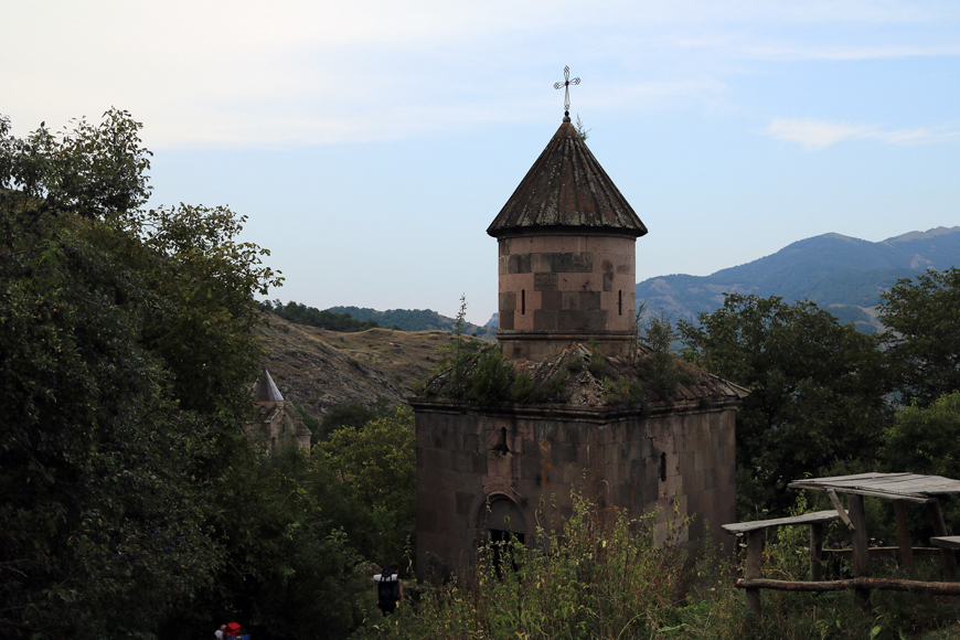
The hike begins near the historical Goshavank site. Starting from a narrow street by the parking area, the trail gently ascends, passing by St. Sarkis Chapel and the tomb of Mkhitar Gosh. The winding path provides fantastic views of Goshavank and the nearby rock formations. As you continue, the trail shifts from a vehicle road to a narrow footpath that meanders through the forest.
You'll climb about 200 meters from a point 1,200 meters above sea level. The trail crosses a small stream not far from the village. It then stretches through meadows and forests, eventually leading to Gosh Lake before the 5-kilometer mark. This serene, hidden lake is a perfect spot to rest before continuing.
From there, you'll ascend another 200 meters to reach the highest point of the trail at 1,600 meters, where you'll find the ruins of the medieval Church of Jermakavan. This spot offers impressive views of the valley, surrounding forests, and pastures.
The trail then gradually descends for about 7 kilometers towards Khachardzan village. This section passes old barns, rocky terrain, and follows alongside the river. In the village, you'll pass the central park, gym, and other village amenities. The trail concludes near the entrance to Khachardzan village on the main road, where you can also see the Getik River merging with the Khachardzan River. Here, you can either stay overnight or continue your hike to the nearby village of Agavnavank.
Water sources/information
In Gosh village, water sources are located near the parking area and at the start of the trail. There are no water sources along the trail itself. In Khachardzan village, you can find several natural springs.
Trail Notes
Some sections of the trail to Lake Gosh can be quite damp after rainfall. The areas around the lake, especially those where vehicles have passed, often become muddy. In the forested parts, you may frequently come across fallen branches or large logs blocking the path.