Gomk to Martiros
Gomk to Martiros
3-4h
12.0 km
2212m
1916m
Medium
Things to see
×
Starting on a historic road, this hike will take you from the idyllic village of Gomk, through valleys and past lakes to the beautiful Martirosats Monastery in Old Martiros. Local legend says this holy site is a place where miracles occur.
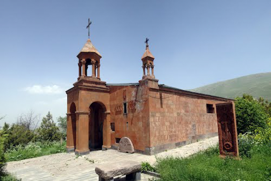
From the western end of Gomk village, the trail goes up the mountainside following a historic cart road, sections of which are still paved with their original cobblestones. You’ll traverse the north-facing mountainside below the peak of Mount Garumk (2,742m), passing above a series of flooded plateaus where numerous freshwater springs once supplied drinking water to inhabitants of ancient settlements in the area. The chapels of Martiros and St. Jacob can both be found just downhill beyond the northern lips of these plateaus. At the midpoint of the trail, the route passes behind the peak of Mount Karhan (2,222m) to the north. Climb the short distance to the peak for a spectacular view of the valley below. From the last plateau, known as Verin Lich (“Upper Lake”), the trail descends towards the almost-abandoned village of Old Martiros, passing Chumov Lake (“chim” is an Armenian word referring to the island in the middle of the lake). At a signposted junction (9.5km), bear left and continue 1km to the rock-hewn Holy Mother of God Church, also known as Martirosats Monastery, which has been carved from the mountainside below the peak of Mount Nazar (2,446m). FYI, the road to Gomk is in bad shape, but it is easier to get to the village of Martiros by car if you want to start your hike from there. Important to note that this section of trail is a part of the planned TCT route across Armenia.
From the western end of Gomk village, the trail goes up the mountainside following a historic cart road, sections of which are still paved with their original cobblestones. You’ll traverse the north-facing mountainside below the peak of Mount Garumk (2,742m), passing above a series of flooded plateaus where numerous freshwater springs once supplied drinking water to inhabitants of ancient settlements in the area. The chapels of Martiros and St. Jacob can both be found just downhill beyond the northern lips of these plateaus. At the midpoint of the trail, the route passes behind the peak of Mount Karhan (2,222m) to the north. Climb the short distance to the peak for a spectacular view of the valley below. From the last plateau, known as Verin Lich (“Upper Lake”), the trail descends towards the almost-abandoned village of Old Martiros, passing Chumov Lake (“chim” is an Armenian word referring to the island in the middle of the lake). At a signposted junction (9.5km), bear left and continue 1km to the rock-hewn Holy Mother of God Church, also known as Martirosats Monastery, which has been carved from the mountainside below the peak of Mount Nazar (2,446m). FYI, the road to Gomk is in bad shape, but it is easier to get to the village of Martiros by car if you want to start your hike from there. Important to note that this section of trail is a part of the planned TCT route across Armenia.


